WSentinel capture software creates 3 primary event files; composite jpg, video(.mp4), and a spreadsheet(.csv) which contains a timehistory of energy, azimuth/elevation, and pixel mapping for the event as seen from the camera location: (see Spreadsheet Column Definitions here).
NOTE: The az/el data in the spreadsheet are approximations and offline calibration is required for refined assessments. Refined calibrations require use of the nightly composites which are available via the link on the right side of this page.
If you don't see an event, or you are looking for data over 30 days old, please contact us at: 
Node Events (last 30 days)
|
|
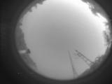
Date: July 12 2025
Time: 04:03:02.20 UTC
|
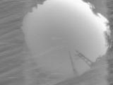
Date: July 12 2025
Time: 04:02:55.491 UTC
|

Date: July 12 2025
Time: 03:36:23.358 UTC
|

Date: July 12 2025
Time: 03:30:23.361 UTC
|

Date: July 12 2025
Time: 03:24:55.719 UTC
|

Date: July 12 2025
Time: 03:19:21.401 UTC
|

Date: July 12 2025
Time: 03:13:52.715 UTC
|

Date: July 12 2025
Time: 03:08:23.380 UTC
|

Date: July 12 2025
Time: 03:02:56.662 UTC
|

Date: July 12 2025
Time: 02:58:47.73 UTC
|

Date: July 12 2025
Time: 02:53:08.212 UTC
|

Date: July 12 2025
Time: 02:52:34.361 UTC
|
Date: July 12 2025
Time: 02:40:52.912 UTC
|

Date: July 12 2025
Time: 02:37:23.209 UTC
|
Date: July 12 2025
Time: 02:29:46.149 UTC
|

Date: July 12 2025
Time: 02:24:17.708 UTC
|

Date: July 12 2025
Time: 02:18:49.395 UTC
|

Date: July 12 2025
Time: 02:16:11.270 UTC
|

Date: July 12 2025
Time: 02:15:37.809 UTC
|

Date: July 12 2025
Time: 02:02:18.71 UTC
|
|
