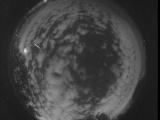
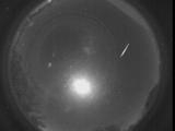
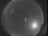
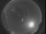
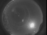
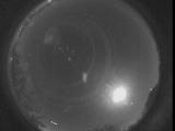
WSentinel capture software creates 3 primary event files; composite jpg, video(.mp4), and a spreadsheet(.csv) which contains a timehistory of energy, azimuth/elevation, and pixel mapping for the event as seen from the camera location: (see Spreadsheet Column Definitions here).
NOTE: The az/el data in the spreadsheet are approximations and offline calibration is required for refined assessments. Refined calibrations require use of the nightly composites which are available via the link on the right side of this page.
If you don't see an event, or you are looking for data over 30 days old, please contact us at: 
Node Events (last 30 days)
|
|
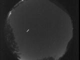
Date: October 18 2025
Time: 03:04:27.826 UTC
|

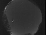
Date: October 18 2025
Time: 03:04:23.906 UTC
|

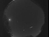
Date: October 18 2025
Time: 03:04:19.499 UTC
|
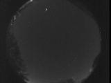
Date: October 18 2025
Time: 03:04:14.784 UTC
|

Date: October 18 2025
Time: 03:04:10.387 UTC
|

Date: October 18 2025
Time: 03:03:46.837 UTC
|
Date: October 16 2025
Time: 11:45:02.444 UTC
|
Date: October 16 2025
Time: 05:58:32.617 UTC
|
Date: October 15 2025
Time: 09:51:34.714 UTC
|
Date: October 8 2025
Time: 07:59:54.906 UTC
|
Date: October 6 2025
Time: 09:39:01.59 UTC
|

Date: October 6 2025
Time: 09:08:30.661 UTC
|
Date: October 6 2025
Time: 09:08:27.987 UTC
|

Date: October 6 2025
Time: 09:08:25.295 UTC
|

Date: October 6 2025
Time: 09:08:22.541 UTC
|

Date: October 6 2025
Time: 09:08:19.972 UTC
|
Date: October 6 2025
Time: 09:07:50.311 UTC
|
Date: October 6 2025
Time: 09:07:01.961 UTC
|

Date: October 6 2025
Time: 09:06:58.501 UTC
|

Date: October 6 2025
Time: 09:06:55.492 UTC
|
|
