WSentinel capture software creates 3 primary event files; composite jpg, video(.mp4), and a spreadsheet(.csv) which contains a timehistory of energy, azimuth/elevation, and pixel mapping for the event as seen from the camera location: (see Spreadsheet Column Definitions here).
NOTE: The az/el data in the spreadsheet are approximations and offline calibration is required for refined assessments. Refined calibrations require use of the nightly composites which are available via the link on the right side of this page.
If you don't see an event, or you are looking for data over 10 days old, please contact us at: 
Node Events (last 30 days)
|
|
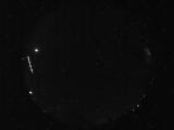
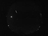
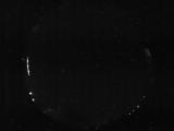
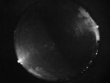
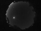
Date: July 10 2026
Time: 10:18:16.241 UTC
|
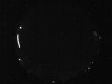
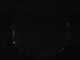
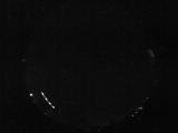
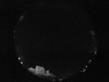
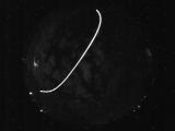
Date: July 10 2026
Time: 09:25:27.755 UTC
|
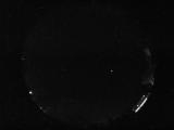
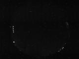
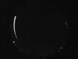
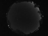
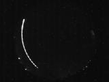
Date: July 10 2026
Time: 05:07:42.222 UTC
|
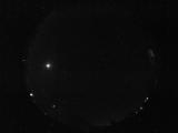
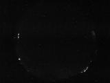
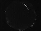
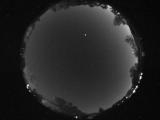
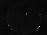
Date: July 9 2026
Time: 10:55:01.475 UTC
|
Date: July 9 2026
Time: 10:17:43.142 UTC
|
Date: July 9 2026
Time: 06:57:14.265 UTC
|
Date: July 9 2026
Time: 06:57:11.421 UTC
|
Date: July 9 2026
Time: 06:57:08.577 UTC
|
Date: July 9 2026
Time: 06:43:04.195 UTC
|
Date: July 9 2026
Time: 06:16:53.663 UTC
|
Date: July 9 2026
Time: 06:16:39.803 UTC
|
Date: July 9 2026
Time: 04:55:37.760 UTC
|
Date: July 9 2026
Time: 04:18:15.144 UTC
|
Date: July 9 2026
Time: 04:12:47.678 UTC
|
Date: July 9 2026
Time: 03:45:29.2 UTC
|
Date: July 9 2026
Time: 03:38:16.736 UTC
|
Date: July 8 2026
Time: 11:21:07.259 UTC
|
Date: July 8 2026
Time: 08:57:29.464 UTC
|
Date: July 8 2026
Time: 06:49:48.872 UTC
|
Date: July 8 2026
Time: 06:29:11.652 UTC
|
|
