WSentinel capture software creates 3 primary event files; composite jpg, video(.mp4), and a spreadsheet(.csv) which contains a timehistory of energy, azimuth/elevation, and pixel mapping for the event as seen from the camera location: (see Spreadsheet Column Definitions here).
NOTE: The az/el data in the spreadsheet are approximations and offline calibration is required for refined assessments. Refined calibrations require use of the nightly composites which are available via the link on the right side of this page.
If you don't see an event, or you are looking for data over 30 days old, please contact us at: 
Node Events (last 30 days)
|
|

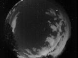
Date: July 23 2025
Time: 07:26:13.118 UTC
|

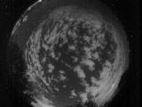
Date: July 23 2025
Time: 07:26:10.522 UTC
|

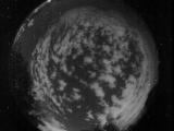
Date: July 23 2025
Time: 07:26:07.918 UTC
|

Date: July 23 2025
Time: 07:26:05.591 UTC
|

Date: July 23 2025
Time: 07:26:02.978 UTC
|
Date: July 23 2025
Time: 07:25:59.676 UTC
|

Date: July 23 2025
Time: 07:25:56.502 UTC
|

Date: July 23 2025
Time: 07:25:53.836 UTC
|

Date: July 23 2025
Time: 07:25:51.377 UTC
|

Date: July 23 2025
Time: 07:25:48.826 UTC
|

Date: July 23 2025
Time: 07:25:46.343 UTC
|

Date: July 23 2025
Time: 07:25:41.86 UTC
|

Date: July 23 2025
Time: 07:25:38.693 UTC
|

Date: July 23 2025
Time: 07:25:35.986 UTC
|

Date: July 23 2025
Time: 07:25:33.416 UTC
|

Date: July 23 2025
Time: 07:25:30.915 UTC
|
Date: July 23 2025
Time: 06:57:55.348 UTC
|

Date: July 23 2025
Time: 06:57:52.817 UTC
|

Date: July 23 2025
Time: 06:57:37.401 UTC
|
Date: July 23 2025
Time: 06:57:32.228 UTC
|
|
