WSentinel capture software creates 3 primary event files; composite jpg, video(.mp4), and a spreadsheet(.csv) which contains a timehistory of energy, azimuth/elevation, and pixel mapping for the event as seen from the camera location: (see Spreadsheet Column Definitions here).
NOTE: The az/el data in the spreadsheet are approximations and offline calibration is required for refined assessments. Refined calibrations require use of the nightly composites which are available via the link on the right side of this page.
If you don't see an event, or you are looking for data over 10 days old, please contact us at: 
Node Events (last 30 days)
|
|
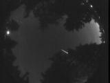
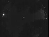
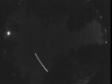
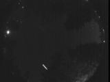
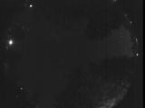
Date: July 9 2026
Time: 05:23:48.424 UTC
|
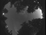
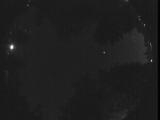
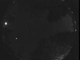
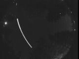
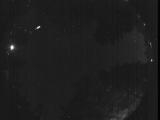
Date: July 9 2026
Time: 05:13:08.514 UTC
|
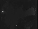
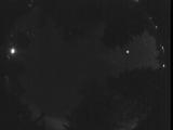
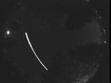
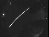
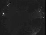
Date: July 8 2026
Time: 06:43:43.492 UTC
|
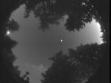
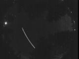
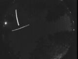
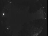
Date: July 5 2026
Time: 05:17:05.570 UTC
|
Date: June 20 2026
Time: 09:48:45.133 UTC
|
Date: June 20 2026
Time: 07:09:23.300 UTC
|
Date: June 19 2026
Time: 08:59:04.578 UTC
|
Date: June 19 2026
Time: 08:51:36.897 UTC
|
Date: June 19 2026
Time: 08:26:26.106 UTC
|
Date: June 19 2026
Time: 08:15:57.726 UTC
|
Date: June 19 2026
Time: 08:10:17.713 UTC
|
Date: June 19 2026
Time: 08:09:44.143 UTC
|
Date: June 19 2026
Time: 08:09:09.443 UTC
|
Date: June 19 2026
Time: 08:08:35.243 UTC
|

Date: June 19 2026
Time: 08:08:09.152 UTC
|
Date: June 19 2026
Time: 08:07:23.443 UTC
|
Date: June 19 2026
Time: 08:07:08.232 UTC
|
Date: June 19 2026
Time: 08:07:01.262 UTC
|
Date: June 19 2026
Time: 07:51:45.400 UTC
|
Date: June 19 2026
Time: 06:45:10.778 UTC
|
|
