WSentinel capture software creates 3 primary event files; composite jpg, video(.mp4), and a spreadsheet(.csv) which contains a timehistory of energy, azimuth/elevation, and pixel mapping for the event as seen from the camera location: (see Spreadsheet Column Definitions here).
NOTE: The az/el data in the spreadsheet are approximations and offline calibration is required for refined assessments. Refined calibrations require use of the nightly composites which are available via the link on the right side of this page.
If you don't see an event, or you are looking for data over 30 days old, please contact us at: 
Node Events (last 30 days)
|
|
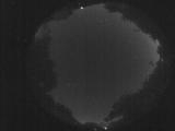
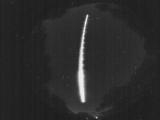
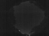
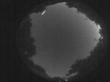
Date: July 28 2025
Time: 01:39:27.83 UTC
|
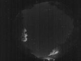
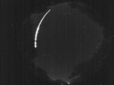
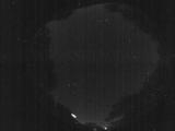
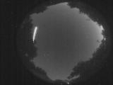
Date: July 27 2025
Time: 02:35:24.766 UTC
|
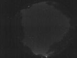
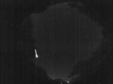
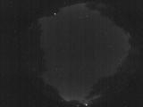
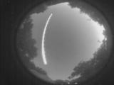
Date: July 27 2025
Time: 02:22:55.550 UTC
|
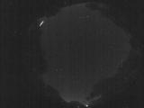
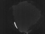
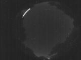
Date: July 27 2025
Time: 02:20:32.643 UTC
|
Date: July 27 2025
Time: 02:07:29.459 UTC
|
Date: July 27 2025
Time: 02:01:03.156 UTC
|
Date: July 27 2025
Time: 02:01:00.626 UTC
|
Date: July 27 2025
Time: 02:00:50.986 UTC
|
Date: July 27 2025
Time: 02:00:48.776 UTC
|
Date: July 27 2025
Time: 02:00:43.976 UTC
|
Date: July 27 2025
Time: 01:47:41.333 UTC
|
Date: July 27 2025
Time: 01:47:29.952 UTC
|

Date: July 27 2025
Time: 01:27:36.816 UTC
|
Date: July 27 2025
Time: 01:27:34.76 UTC
|
Date: July 27 2025
Time: 01:27:21.996 UTC
|

Date: July 27 2025
Time: 01:27:09.857 UTC
|

Date: July 27 2025
Time: 01:27:07.947 UTC
|

Date: July 27 2025
Time: 01:27:05.146 UTC
|

Date: July 27 2025
Time: 01:27:01.606 UTC
|
Date: July 27 2025
Time: 01:20:32.904 UTC
|
|
