WSentinel capture software creates 3 primary event files; composite jpg, video(.mp4), and a spreadsheet(.csv) which contains a timehistory of energy, azimuth/elevation, and pixel mapping for the event as seen from the camera location: (see Spreadsheet Column Definitions here).
NOTE: The az/el data in the spreadsheet are approximations and offline calibration is required for refined assessments. Refined calibrations require use of the nightly composites which are available via the link on the right side of this page.
If you don't see an event, or you are looking for data over 30 days old, please contact us at: 
Node Events (last 30 days)
|
|
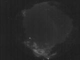
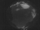
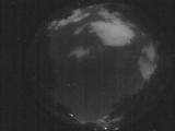
Date: July 26 2025
Time: 10:59:59.411 UTC
|
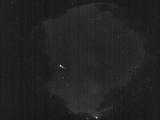
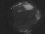
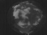
Date: July 26 2025
Time: 10:59:49.101 UTC
|
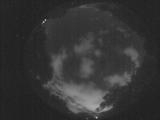
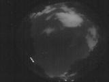
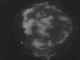
Date: July 26 2025
Time: 10:59:44.791 UTC
|

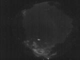
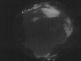
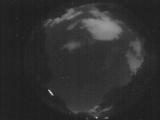
Date: July 26 2025
Time: 10:59:42.891 UTC
|
Date: July 26 2025
Time: 08:16:44.656 UTC
|
Date: July 26 2025
Time: 08:16:32.6 UTC
|
Date: July 26 2025
Time: 07:15:02.618 UTC
|
Date: July 26 2025
Time: 03:12:21.638 UTC
|
Date: July 26 2025
Time: 03:03:39.877 UTC
|
Date: July 26 2025
Time: 03:03:37.207 UTC
|
Date: July 26 2025
Time: 03:03:35.107 UTC
|
Date: July 26 2025
Time: 03:03:10.118 UTC
|
Date: July 26 2025
Time: 03:03:06.708 UTC
|
Date: July 26 2025
Time: 03:02:56.597 UTC
|

Date: July 26 2025
Time: 02:56:38.745 UTC
|
Date: July 26 2025
Time: 02:56:36.875 UTC
|

Date: July 26 2025
Time: 02:56:34.435 UTC
|

Date: July 26 2025
Time: 02:56:31.735 UTC
|
Date: July 26 2025
Time: 02:56:07.805 UTC
|

Date: July 26 2025
Time: 02:56:05.875 UTC
|
|
