WSentinel capture software creates 3 primary event files; composite jpg, video(.mp4), and a spreadsheet(.csv) which contains a timehistory of energy, azimuth/elevation, and pixel mapping for the event as seen from the camera location: (see Spreadsheet Column Definitions here).
NOTE: The az/el data in the spreadsheet are approximations and offline calibration is required for refined assessments. Refined calibrations require use of the nightly composites which are available via the link on the right side of this page.
If you don't see an event, or you are looking for data over 30 days old, please contact us at: 
Node Events (last 30 days)
|
|
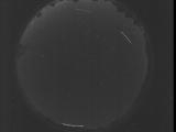
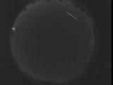
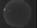
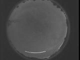
Date: July 30 2025
Time: 02:05:33.931 UTC
|

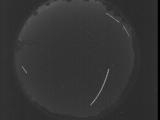
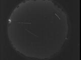
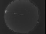
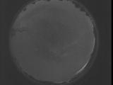
Date: July 30 2025
Time: 02:00:06.323 UTC
|
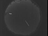
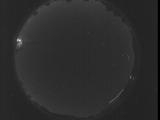
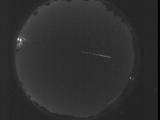
Date: July 30 2025
Time: 01:54:38.773 UTC
|
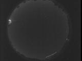
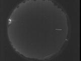
Date: July 30 2025
Time: 01:49:11.164 UTC
|
Date: July 30 2025
Time: 01:43:43.626 UTC
|
Date: July 30 2025
Time: 01:39:30.78 UTC
|
Date: July 30 2025
Time: 01:38:56.618 UTC
|

Date: July 30 2025
Time: 01:38:23.148 UTC
|

Date: July 30 2025
Time: 01:37:49.688 UTC
|
Date: July 30 2025
Time: 01:37:16.217 UTC
|
Date: July 30 2025
Time: 01:36:42.757 UTC
|

Date: July 30 2025
Time: 01:36:09.289 UTC
|

Date: July 30 2025
Time: 01:35:35.828 UTC
|

Date: July 30 2025
Time: 01:35:02.359 UTC
|
Date: July 30 2025
Time: 01:34:28.899 UTC
|
Date: July 30 2025
Time: 01:33:55.428 UTC
|
Date: July 30 2025
Time: 01:33:21.968 UTC
|
Date: July 30 2025
Time: 01:32:48.498 UTC
|
Date: July 29 2025
Time: 08:55:17.938 UTC
|
Date: July 29 2025
Time: 08:49:50.398 UTC
|
|
