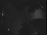
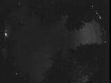
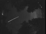
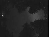
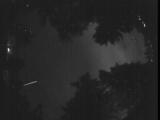
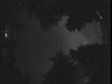
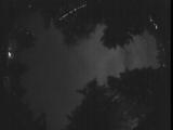
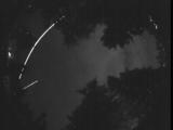
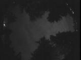
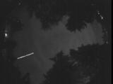
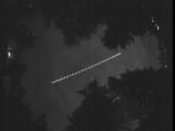
WSentinel capture software creates 3 primary event files; composite jpg, video(.mp4), and a spreadsheet(.csv) which contains a timehistory of energy, azimuth/elevation, and pixel mapping for the event as seen from the camera location: (see Spreadsheet Column Definitions here).
NOTE: The az/el data in the spreadsheet are approximations and offline calibration is required for refined assessments. Refined calibrations require use of the nightly composites which are available via the link on the right side of this page.
If you don't see an event, or you are looking for data over 30 days old, please contact us at: 
Node Events (last 30 days)
|
|
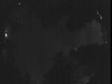
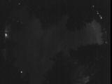
Date: July 4 2025
Time: 10:03:30.921 UTC
|
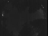
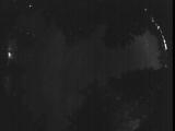
Date: July 4 2025
Time: 09:57:36.479 UTC
|
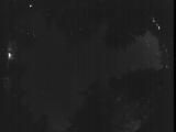
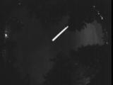
Date: July 4 2025
Time: 09:56:18.206 UTC
|
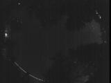
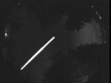
Date: July 4 2025
Time: 09:53:53.129 UTC
|
Date: July 4 2025
Time: 09:23:09.531 UTC
|
Date: July 4 2025
Time: 09:18:06.915 UTC
|
Date: July 4 2025
Time: 08:54:08.318 UTC
|
Date: July 4 2025
Time: 08:53:34.324 UTC
|
Date: July 4 2025
Time: 08:53:21.639 UTC
|
Date: July 4 2025
Time: 08:52:33.296 UTC
|
Date: July 4 2025
Time: 08:13:59.934 UTC
|
Date: July 4 2025
Time: 08:08:05.197 UTC
|

Date: July 4 2025
Time: 08:03:59.461 UTC
|
Date: July 4 2025
Time: 08:02:53.500 UTC
|
Date: July 4 2025
Time: 08:00:25.827 UTC
|
Date: July 4 2025
Time: 07:49:17.835 UTC
|
Date: July 4 2025
Time: 07:48:43.235 UTC
|
Date: July 4 2025
Time: 07:37:06.741 UTC
|
Date: July 4 2025
Time: 07:31:09.161 UTC
|
Date: July 4 2025
Time: 07:30:33.964 UTC
|
|
