WSentinel capture software creates 3 primary event files; composite jpg, video(.mp4), and a spreadsheet(.csv) which contains a timehistory of energy, azimuth/elevation, and pixel mapping for the event as seen from the camera location: (see Spreadsheet Column Definitions here).
NOTE: The az/el data in the spreadsheet are approximations and offline calibration is required for refined assessments. Refined calibrations require use of the nightly composites which are available via the link on the right side of this page.
If you don't see an event, or you are looking for data over 10 days old, please contact us at: 
Node Events (last 30 days)
|
|
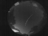
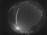
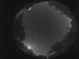
Date: June 29 2026
Time: 02:06:47.697 UTC
|
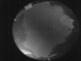
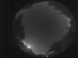
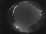
Date: June 29 2026
Time: 01:51:24.226 UTC
|
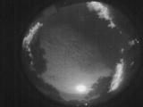
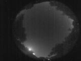
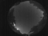
Date: June 28 2026
Time: 04:32:23.828 UTC
|

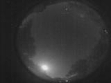
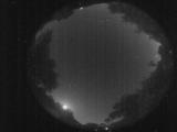
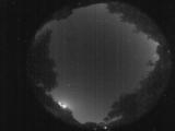
Date: June 28 2026
Time: 02:42:28.835 UTC
|
Date: June 28 2026
Time: 02:18:36.904 UTC
|

Date: June 28 2026
Time: 02:18:18.54 UTC
|
Date: June 28 2026
Time: 01:53:59.321 UTC
|

Date: June 28 2026
Time: 01:50:09.64 UTC
|

Date: June 28 2026
Time: 01:50:02.64 UTC
|
Date: June 28 2026
Time: 01:49:59.854 UTC
|
Date: June 28 2026
Time: 01:49:51.684 UTC
|
Date: June 28 2026
Time: 01:48:40.85 UTC
|

Date: June 28 2026
Time: 01:48:31.306 UTC
|

Date: June 28 2026
Time: 01:48:29.106 UTC
|
Date: June 28 2026
Time: 01:48:26.935 UTC
|
Date: June 28 2026
Time: 01:48:16.26 UTC
|
Date: June 28 2026
Time: 01:48:08.956 UTC
|

Date: June 28 2026
Time: 01:48:04.246 UTC
|
Date: June 28 2026
Time: 01:48:02.446 UTC
|
Date: June 27 2026
Time: 23:13:53.979 UTC
|
|
